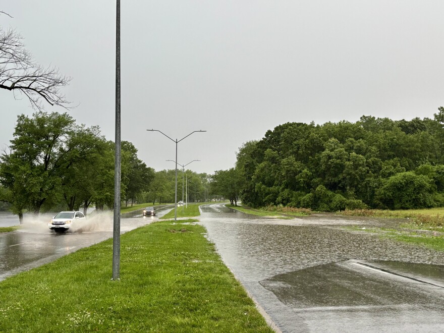
Damage around the Kansas City metro appears to be limited after a tornadic storm system moved through Tuesday afternoon, and there were no immediate reports of widespread injuries.
Tornado warnings were called Tuesday afternoon for Johnson County, Kansas, and Jackson County, Missouri, as well as several surrounding counties. Those have since been canceled.
The National Weather Service warned of a “confirmed large and extremely dangerous” tornado near Raytown and Independence. The tornado moved eastward towards Buckner, Missouri, but its size and strength have yet to be verified.
Some damage, including downed trees and power lines, was reported in Overland Park, Kansas; the Truman Sports Complex, which houses the Royals’ Kauffman Stadium and the Chiefs’ Arrowhead Stadium; and Independence, Missouri.

More than one semi truck overturned on highways during the storm, and officials temporarily closed some roads because of flash flooding.
As of 8:30 p.m., Evergy reported nearly 4,000 customers without power. Independence Power and Light said more than 800 of its customers were without power.
"This remains an ever-evolving situation," Kansas City's emergency operations team said in a news release.
Jackson County officials said they were ready to assist local first responders if needed.
“While full assessments are still underway, we’re incredible grateful for the swift and selfless actions of our emergency responders and residents,” Jackson County Executive Frank White Jr. said in a statement.


White said additional rainfall and storms could return Tuesday evening. He said residents should avoid driving through standing water as the risk of flooding continues.
A flood watch remains in effect for Jackson, Clay, Platte and several other northwest Missouri counties through Wednesday morning.
The weather service said that as of 7 p.m., 2.46 inches of rain had fallen in the area, which broke a daily record of 2.25 inches set in 2015.

In Independence, Evan and Isabel King had just returned from the hospital, where they were checking on their mother after surgery, to discover a tree split in two on their fence and power line.
"We got home to no power and we got home to these limbs being down with a sign saying road closed," said Evan King, 30. "We had no idea about this."
Isabel King, 29, said they had two pet cattle dogs who sit in that area of the yard — but they were inside all day.
"We keep them in a little enclosed room in the back, and they have little huts they get into if there are fireworks or anything like that, that's their safe space," Isabel King said. "They were in their hut when this all happened, and fortunately nothing fell on that top on that area of the house."

"We know that not everyone was as fortunate as us," Isabel King continued. "Our hearts do go out to the ones who saw the worst-case scenario."
Resident Eric Johnson was walking near Indian Creek in south Kansas City shortly after the storm moved through the area. Normally, Johnson said, he would rate the creek's water intensity at a 2 out of 10. On Tuesday afternoon, he gave it a 6.
“Right now, it is not peaceful,” he said. “It’s a raging river that is kind of frightening.”
Johnson encouraged others to keep an eye on the water level from a safe distance.
“Definitely don’t try to go fishing or play in it or swim with a life jacket,” he said. “Take a look at the water levels and listen for flood warnings.”
Kansas City, Missouri, announced that KCATA and Streetcar operations have resumed, and community centers are open with regular hours. However, pools around the metro closed for the day.
"More than 50 street maintenance crews are monitoring the roads for damage, debris and flooding," Kansas City's emergency operations team said in a statement.
Kansas City residents can report storm damage through the myKCMO app or by calling 311.
Our Emergency Operation team is continuing to monitor the weather. After the storm, cleanup will take time. Please stay off the roads if you can and let crews work safely. https://t.co/hYVgmTSXcH
— Kansas City (@KansasCity) June 3, 2025
Heavy rain and flooding remain the biggest potential weather risks for the rest of the week.
"We’re going to get more showers and storms that’ll move into the area, most likely on
Thursday night into Friday," said National Weather Service meteorologist Chad Omitt on Tuesday.
However, Omitt says the risk for tornadoes appears relatively low the rest of the week.
KCUR's Nomin Ujiyediin and Savannah Hawley-Bates contributed to this report.


