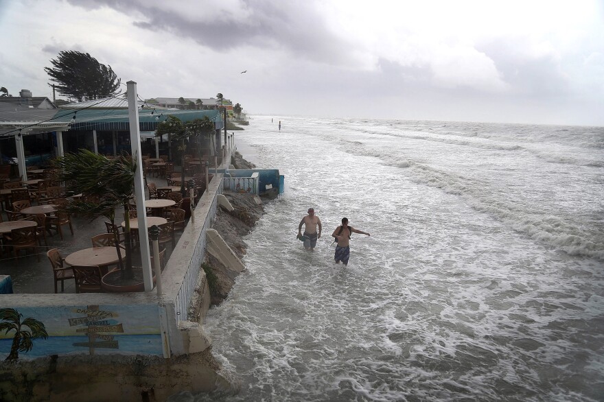
Tropical Storm Colin ripped across the Gulf of Mexico in June and hit the coast of southwest Florida with 60-mile-an-hour winds. Before it arrived, a team from the U.S. Geological Survey used a new computer model to predict how far inland the waves would invade. When the storm hit, the USGS sent Joe Long out to film it.
Long is an oceanographer with the USGS. His video shows waves rushing up the beach to the foot of a sand dune. "So water levels are reaching that high," he says as we watch the video. "They are eroding the face of that dune and creating this pretty steep face."
Just beyond the dunes, you can see a multistory condominium. "If that dune wasn't there," Long explains, "that water would be going onto roadways or hitting the base of those buildings."
When Long goes to the beach, he sees stuff the rest of us don't pay much attention to. He gets excited about "dune toes" (the base of a dune) and "scarp formation" (the creation of a steep dune face). He says he bores his kids at the beach.
But that attention to beach sculpting by ocean waves has helped him design a computer model that predicts something called "wave run-up." During storms, wind pushes a mass of water up toward a beach. That's called surge. But on top of that surge, wind creates waves that reach even higher — wave run-up.
If they're big enough, these waves destroy the dune and wash huge amounts of sand close to shore — or they may carry the sand out to sea. "The model we use is trying to predict the type of coastal change that we would see during a storm," Long explains.
The model is fairly new, but it predicted the level of wave run-up during Colin to within about a foot. It also nailed the amount of erosion the dunes would suffer.
One reason the geological survey has spent years perfecting this model is that the ocean is moving in on us. A warming planet is causing sea levels to rise. "More storms could impact these protective dunes because sea levels are higher," he says.
Our coastlines are increasingly threatened.
And the survey is trying to predict how and where. Florida is near the top of the list. At the survey's offices in St. Petersburg, I walk downstairs to a dimly lit basement lab to visit marine biologist Ilsa Kuffner. She's a coral reef expert.
Shelves are packed with chunks of coral Kuffner has collected. Her job is to find out what happens to waves before they get to the beaches. "The main thrust of our project," she says, "is looking at reefs being barriers that are protecting coastlines."
Reefs slow down incoming swells and waves. The problem is that warmer ocean temperatures are killing a lot of coral, so coral beds shrink down, away from the sea surface. In effect, the water depth increases. "So there's less drag," Kuffner says. "More wave energy can propagate over the reef, so they're not performing as well as breakwaters."
Then, when waves do reach the shore, their effects depend on a lot of things — how steep the beach is, for example, or how high the dunes are. The west coast of Florida, it turns out, isn't very sturdy. "The Gulf is in a really bad state," says Hilary Stockdon, a USGS oceanographer and one of the designers of the model. She says beaches and dunes along the Gulf of Mexico are flat and low, and even a small hurricane would do a lot of damage.
"A direct landfall of a Category 1 [hurricane] almost anywhere in the Gulf of Mexico will cause significant coastal erosion," Stockdon says. That threatens wetlands and barrier islands, as well as roads and buildings.
The team's computer models factor in predictions about the rise in sea level and show lots of places along the East and the Gulf coasts that are increasingly threatened.
"Water is just going to start reaching places that it hasn't reached before," Stockdon says, "and if they don't consider this wave run-up, they're going to miss this important part."
"They" are weather forecasters and emergency response teams from Maine to Mississippi. Stockdon says some are already using the model to prepare.
That makes Nathaniel Plant happy. Plant is the top USGS oceanographer on this project, and he says the goal is to help people prepare — to know where it's going to flood, and also where the waves can't be stopped.
"As a nation, we actually have to decide," Plant says: "What areas are we going to invest in to protect? What areas are we going to let go on their own?"
In some places, he says, the waves are going to win.
Science reporters at NPR are exploring all sorts of waves this summer.
Find more more of our favorites here.
Copyright 2020 NPR. To see more, visit https://www.npr.org.


